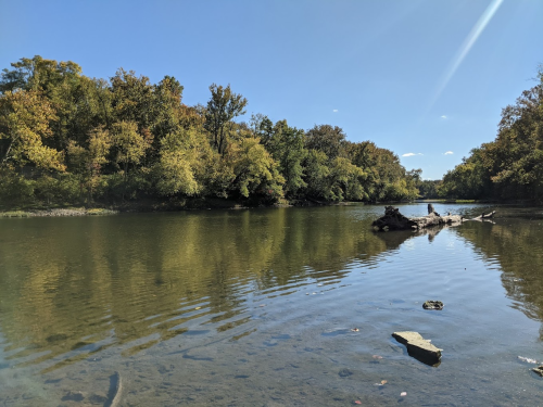
The area that is now Taylorsville MetroPark was once one of the busiest crossroads in the country, the meeting place of major transportation arteries — the Old National Road, Great Miami River, the Miami-Erie Canal and railroads. Today, the area serves as the crossroads of bike trails, hiking trails and river recreation.
Some highlights include several trails, great fishing and birding, geocaching, camping, and Great Miami River access.
Trails
(Information via Five Rivers MetroParks)
Taylorsville Dam
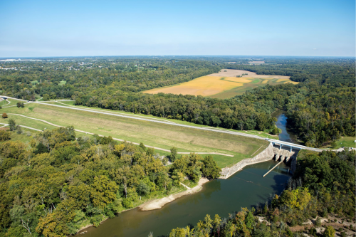
Taylorsville Dam is an earthen embankment located across the Great Miami River in northern Montgomery County near the City of Vandalia. It is one of five dry dams constructed by the Miami Conservancy District in response to the Great Flood of 1913. Construction of the dam began in February of 1918 and was completed in November of 1921. U.S. 40 goes across the top of the dam.
Chief Engineer Arthur Morgan felt strongly that the lands surrounding the dry dams (called storage basins) should be available to the public for outdoor recreation use. The land that is utilized for the flood protection system also provides unparalleled public access to the Great Miami River and its tributaries. More than 20 public jurisdictions in five counties hold permits to operate parks, trails and related attractions on Miami Conservancy District land. Five Rivers MetroParks is the largest of these organizations, providing recreational opportunities on hundreds of acres of flood protection land in the Dayton region.

